Alpine Challenge race recap

Alpine Challenge race recap

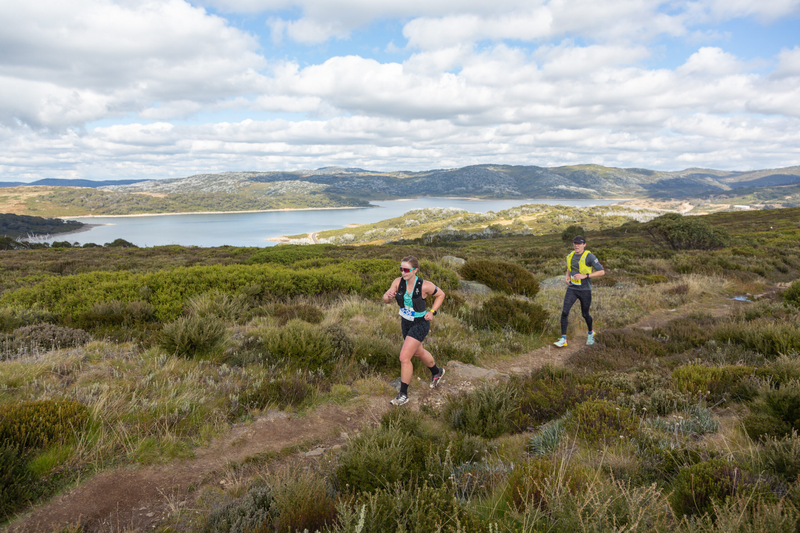
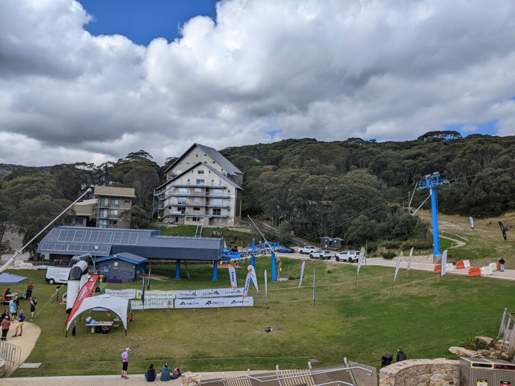
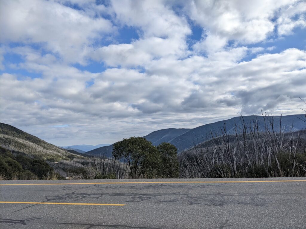
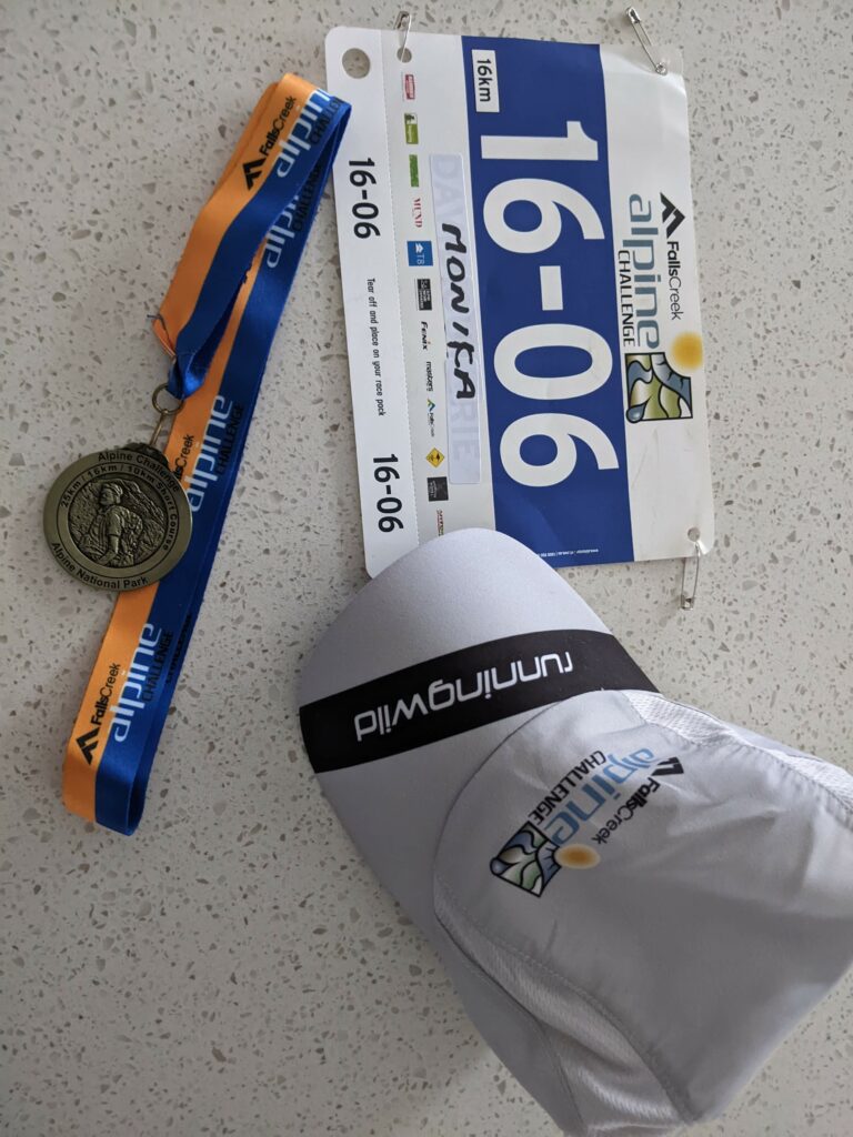
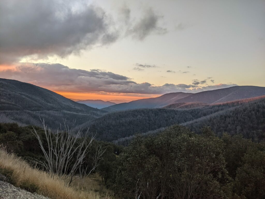
Starting from Falls Creek, the 100 mile Alpine Challenge course ascends Victoria’s two highest mountains, Mt Bogong (1,986m) and Mt Feathertop (1,922m) as well as Mt Hotham, Mt McKay, Spion Kopje and Mt Nelse. The Alpine Challenge also has 100, 60, 42, 16 and 10 kilometre races. I raced the 16km in the Saturday 23 April 2022 edition, which was a postponement date from 2021. There is a further opportunity to compete in the Alpine Challenge in November 2022. For those looking to collect qualifying points for UTMB, finishers of the 100 mile, 100 kilometre and 60km distances all accumulate points.

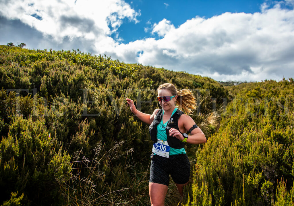
I was in Falls Creek for the start of a holiday and this happily coincided with the Alpine Challenge, so I entered the 16km race to do as a tempo effort. I fractured my foot at the end of January 2022 and was out of running for 8 weeks. Now at week 5 of return to running my ‘long’ run was at 15km and so even this 16km distance was a stretch for my foot, even at a tempo effort.


The Alpine Challenge is a Running Wild event. I have previously competed in the Mt Buller Skyrun also put on by Running Wild. There are two things you should know about Running Wild races before signing up – they take compulsory gear very seriously and these races are not for the navigationally challenged due to sparse and low key course markings. As a result, you will be carrying a full vest of compulsory gear even for the 10-16km distances including overpants, waterproof jacket, gloves, beanie, hard copy map and compass, and that is for all conditions. This is the type of compulsory gear you would ordinarily see in a 50-100km trail race. As a person who takes compulsory gear seriously, I like this approach. However, I already own all the compulsory equipment and so it is not a massive financial investment for me. For those competing in shorter distances who don’t own a hydration vest, ect it could be a real deterrent from entering, and it is definitely different from comparable trail races, so you should be aware of this when signing up for Running Wild races. With the course marking, Running Wild tend to use small and discrete flags marked at long intervals. If you are on a single trail and the race continues along this, you might not see a flag for a couple of kilometres. At turn off points there is usually a flag, but other directional markings are scarce which makes it very easy to miss turn offs, particularly where the flags are white as in the shorter distance races. Running Wild make it very clear on their website that you must be familiar with the course, be confident at navigating and be able to use the map and compass in your compulsory gear. It is just one thing to note before signing up, particularly for long distances, as you will be making navigational decisions at regular intervals, and this is quite a different approach to other trail races, for example UTA, where you would have to really try hard to go off course.

Start and finish. Race goes up a ski slope a short way to join the Aqueduct Trail

Views from village parking. That is Mt Spion Kopje you can see there. I went up that mountain and traversed across to Big River Firetrail the Wednesday after the race.

I was so pumped to be racing the 16km course. When returning to running after an extended injury, every single run feels like such a treat, and I was very keen to see the Falls Creek trails. I had never been to Falls in summer season, having been here a couple of times previously as a child and teenager for skiing, but then subsequently favouring the mountains much closer to Canberra. The shorter distances all started at 10:30am. In my short warm up, my heart rate was a little high. Falls Creek village is at about 1,500m, which is twice as high as the altitude of where I live in Canberra. Ordinarily I would run at this altitude most weekends in Namadgi National Park, but due to my broken foot I had not been able to get to altitude often, which meant I noticed it a little in the race, especially as I had arrived to Falls Creek late the night before.


As this was a small event, there was plenty of space to run your own race and spread out. The first part of the race went up a short ski hill from Slalom Plaza to the aqueduct trail. That first climb my heart rate was through the roof and my legs were screaming at me to turn around. But as per normal at altitude, my heart rate settled and we were then on the super fast aqueduct trail. Falls Creek is actually quite popular for altitude training camps with track and road runners, and the aqueduct trail is frequently used by them due to its flat and fast surface. At the dam wall we veered off from Aquaduct trail, passing down and then up the other side. The second male in front of me missed the turnoff, as the little white flag was not super visible, and so I got to run in second for a short time until he caught back up. This was the first part of grassy running and there were some unexpectedly deep mud sections. The field had spread out nicely when we got to Heathy Spur at the 3km mark. There were two men in the 16km running ahead of me and I had a few men running behind me. Heathy Spur track is a single trail through the heath (surprising, I know). It undulates beautifully with no steep climbs, though has some technical rocky sections. It is a very fast single trail for this kind of alpine running. Due to the low height of the heath we had 360 views all round the Bogong High Plains, and it was a very scenic place for a 16km tempo effort. We passed the 10km turn around cone and continued on. I was swapping positions with the two men running with me. I could tell by their bib colour they were doing the 25km race so I knew I would soon be departing from their company. The way out was mostly gentle climbing, but at the 7km mark there was a gentle descent to the Big River Firetrail. I got to turn around here. The 25km runners continued on to Fitzgerald and Kelly’s Huts.

Running alone on the way back, I could just see the second male Chris Grabham running through the heath about 1km ahead. After the first gentle ascent Heathy Spur track was almost all downhill. There were quite a few hikers carrying multi-day packs presumably doing the Falls Creek to Hotham Traverse, and so as runners we often had to jump into the heath to go around due to the narrow size of the trail. Approaching another hiker I yelled out that I was about to pass. This hiker behaved differently and turned right around and stopped. Turns out it was an event photographer who snapped the feature shot on this blog post (photography was by The Eventurers who cover a lot of the alpine events in the area). The last part of Heathy Spur was quite rocky and technical, but not steep. Once at the Dam Wall I could see Chris on the grassy ascent. He was power hiking. I ran up the grassy slope to Aquaduct Trail for the fast section before the finish. I didn’t catch Chris, who finished second in 1:25 (I finished in 1:27, not as close to Chris as I thought). This was a solid tempo effort and great way to get some racing experience coming back from my broken foot. Running Wild’s alpine races are great if you want a genuine alpine experience, just bring our own navigation skills and be organised with the compulsory gear. 


Swag.

Sunset views on my recovery bike ride.

Almost running over event photographer.

Sunset bike ride.


Leave a Reply

Your email address will not be published. Required fields are marked *