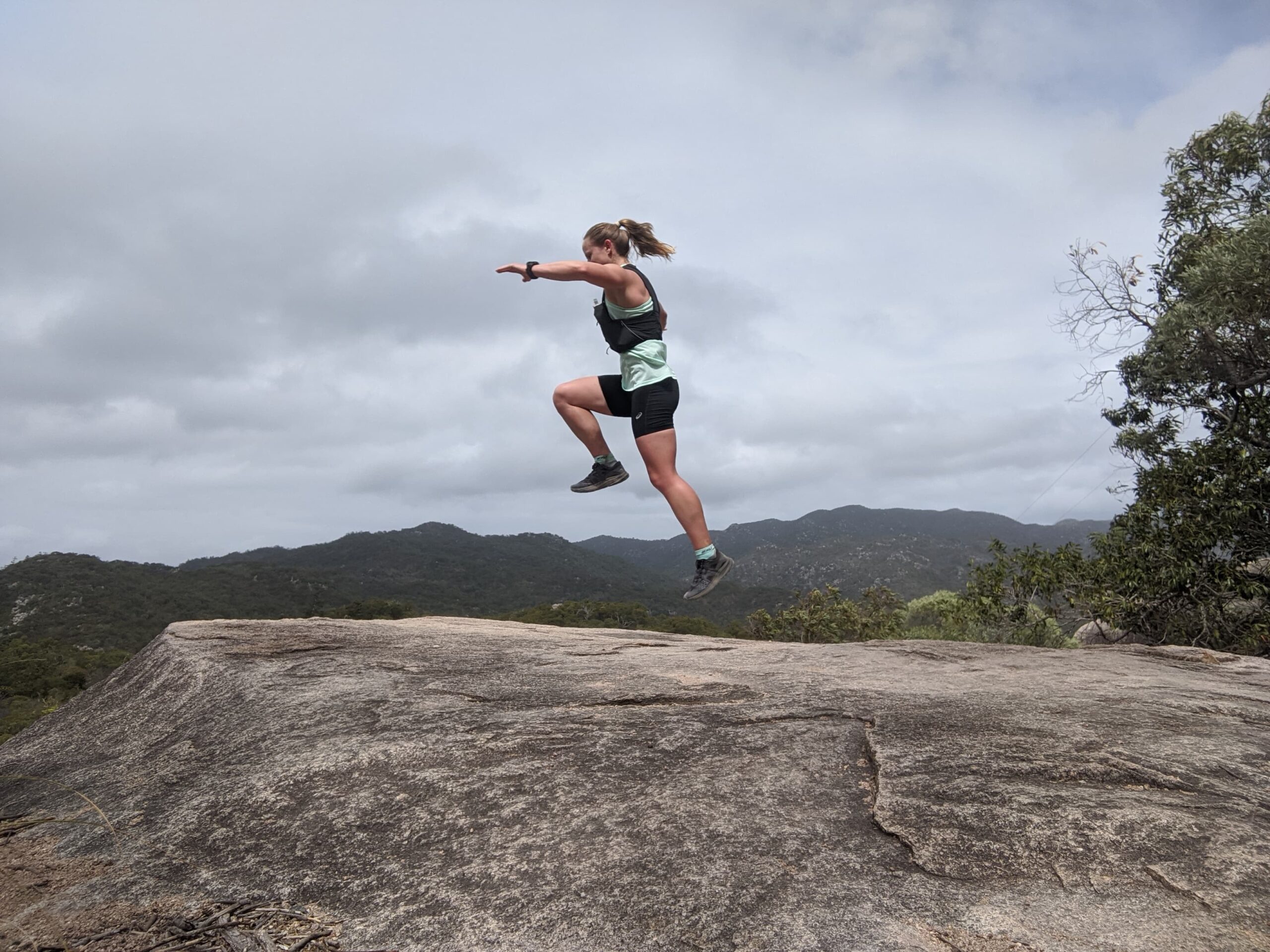
Solo adventures in Queensland – Mt Bartle Frere and Mt Halifax
Henrietta Creek Campground Carpark, Wooroonooran NP, Queensland
I am standing next to my hire van having just finished a run to Nandroya Falls. A car pulls up and a lady steps out. She has long curly black hair and unusual tattoos visible on her arms and neck. On closer inspection I see they are all star constellations and I am pretty sure I can identify scorpio. She looks very dangerous and mysterious. I try to pretend I am not interested in her and step inside my van but she starts a conversation anyway.
Tattoo lady: Have you been running?
Me: Yes just around to some of the waterfalls.
Tattoo lady: Are you by yourself?
Me: Yes, I was running by myself.
Tattoo lady: I mean, are you travelling alone?
Me: Yes, I am travelling alone.
Tattoo lady: What star sign are you?
Me: I am fairly sure I am a Leo.
Tattoo lady: That is why you are alone.
Okayyyyyyyy. Luckily at that moment her partner told her to hurry up with the toilet stop and she left me in peace. I can tell you now there are multiple reasons why I was travelling and adventuring alone and not one of those reasons was because my star sign is Leo.
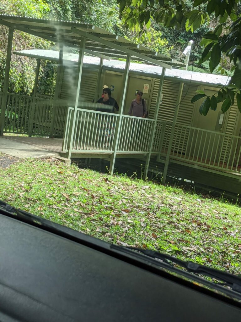
Henrietta Falls Campground carpark where I tried to get a picture of tattoo lady from my van.
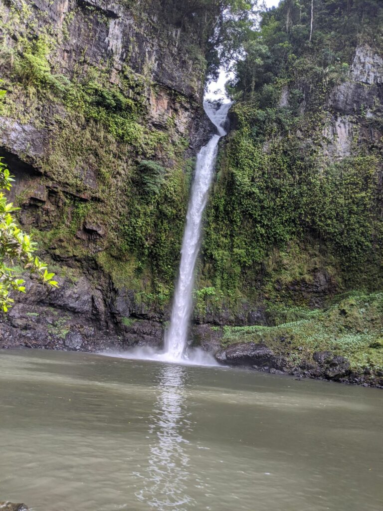
Nandroya Falls, Wooroonooran NP
Why go on solo adventures?
There are both practical reasons and other reasons why I go on solo adventures. Practically, it is not always possible to organise to go on an adventure with others. Your annual leave might not overlap with others. Your friends might all have children who have sports carnivals the day you are going on your adventure. Your friends might simply not be interested in going up a mountain. It might be a choice between going solo or not going at all. In my early 20s I would spend more time on group adventures, especially when kayaking or doing water sports and I would only do small solo trips like doing the Spit to Manly trail run by myself. I would not have gone on weekend adventures by myself or considered a solo holiday and I definitely would not have gone anywhere out of phone range by myself. When I started trail running in 2017 I did most of my runs in groups through social runs organised by Trail Running SA. However, my confidence soon grew and I was running solo around national parks, mainly Cleland CP to get in enough kilometres each week.
When I moved to Canberra in 2018 was when I really started doing solo adventures. Namadgi NP and the Brindabellas are very close to Canberra. These mountains are mainly in wilderness areas and mostly with no phone reception, so I had to learn very quickly how to go on solo adventures safely, especially given I had just moved interstate and did not have a massive pool of friends to draw on. Since then I have been a convert to solo adventures.
The main reason I love solo adventures is how much they have developed my confidence and improved the way I talk to myself. As a flow on effect, this has helped me enhance the way I talk to others. If you are starting to panic, are lost, have heat illness or are so cold you can’t feel any of your limbs, the only way out of the situation is to rely on yourself (or use your PLB). Negative self-talk does not get you very far in these situations. Enduring these discomfort and being forced to be self-reliant also builds resilience. I also find the experience with solo adventures helps me in race situations. Usually when something goes wrong in a race whether it be a navigational error or the weather, I have endured that before usually in worse circumstances where there is not a race director and medical team to watch out for you. As a result whenever I am racing I feel so safe.
I was in Queensland on a holiday by myself because I only had annual leave approved at quite short notice and with the South Australian government threatening closure of the border to Queensland every few days I was quite convinced the trip would not happen. I booked my flights a week and hire van four days before I left. I planned my trip to minimise potential exposure to covid, and that included spending most of the time in national parks in a van rather than staying in urban centres in hostels, hotels or airbnbs. Even if I could arrange for a friend to come along, they probably would not be happy to spend so much time out of civilisation.
I had four adventures I wanted to do on this trip to tropical Far North Queensland:
1. Mt Bartle Frere
2. Mt Halifax
3. Hitchinbrook Island traverse
4. Walsh’s Pyramid
This was more a wishlist and in the end I did not do get to Hitchinbrook Island. The Hitchinbrook track is 31km long and usually hiked over 3 days. It does not go over the mountainous ridge on the island, but is still technical single trail and involves several kilometres of boulder hopping along the beaches and some climbing next to waterfalls. Logistically you need to plan very carefully for Hitchinbrook, as it involves getting a private charter from Cardwell to be dropped off on one side of the island and then organising a charter to be picked up from Lucinda. Both the drop off and pick up points are on mangrove flats frequented by crocodiles and there are a couple of river crossings that need to be done at low tide for croc safety. The boat trip alone would have cost $250-$300 so I left this adventure for another day. To be honest even if I was in the area again, Hitchinbrook would not be my top priority as there are plenty of mountains on mainland I still would like to explore. I also did not get to climb Walsh’s Pyramid closer to Cairns as I decided to run a loop in Barron Gorge National Park instead, and I do not regret that choice as it was fun running in techty rainforest a final time. I also did the Cape Pallarenda trail race half way through my fortnight in Queensland, which took a few days out afterwards to recover from.
Mt Bartle Frere
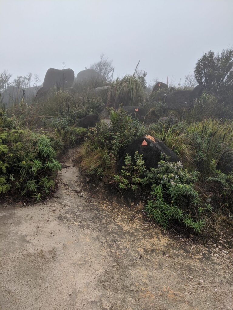
Mt Bartle Frere is Queensland’s highest mountain at 1,622m above sea level. It does not sound very high, but the hike starts at only 100m above sea level so the ascent has 1,400m of vert in 7.5km. This is one of the steepest ascents up a mountain in Australia and is definitely one of the most technical mountains I have run up with roots, rocks and technical single trail. The peak is almost perpetually shrouded in cloud with views only 15-30 days a year. Even if you are lucky to get a dry day with views on the way up, the summit itself has no views due to the heights of the surrounding rainforest. The last section of track up to the summit is a near vertical crawl up a creek bed with exposed roots, so it is a fairly humbling experience even when you finally make it. I went on a drizzly wet day at the end of dry season and it was still super slippery throughout.
I chose the day after I arrived in Cairns to climb up Mt Bartle Frere. The day before I had done acclimatisation hikes to Clamshell Falls in Behana Gorge and Babinda Boulders and also learned how to drive the hire van. Although the heat and humidity was stifling coming from a cool climate there was torrential rain forecast for the rest of that week so I didn’t have time to wait to acclimatise. You do not want to go up Mt Bartle Frere in torrential rain.
The track starts here at the top of Josephine Falls Carpark. [All photos taken on the descent]
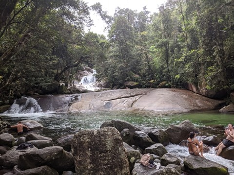
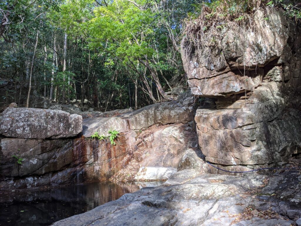
Josephine Falls – where I swum afterwards and also where I ran to initially when I took the wrong trail.
The track starts at the Josephine Falls carpark just beyond the picnic tables with a subtle sign. I had assumed the track branched off Josephine Falls, so I did an accidental warm up run to the falls before looping back to the carpark. The track is immediately technical with rocks, roots and creek crossings, with every step a potential trip hazard. By the time I started it was 7:30am, but underneath the rainforest canopy it was so dark I could definitely have used a headlight. At about the 2km mark I tripped on a root and flew off into the rainforest, collecting my first leeches and coating myself in some nice rainforest mud. That was the first time I have tripped on a trail for years, and just after passing an eerie memorial for a school age child that went missing on Bartle Frere. The terrain continued to undulate taking in two river crossings. The rocks were treacherously slippery, covered in thick moss so I walked through the rivers instead of trying to rock hop. I should also mention I was wearing salomon shoes with standard but not great grip as I had to cater for my plantar fasciitis. But even if you had footwear with excellent grip you would find this track slippery.
By this stage it was apparent that I was going to aim for a summit and safe return rather than any kind of fast time. At the 3km mark the terrain suddenly becomes very steep with several parts that involve climbing on all fours using tree roots to pull yourself up. Although very technical, the track is navigationally easy to follow. By the 4km mark I was almost 100% power walking with a few little running steps here and there in the rare runnable sections. It is also here that the leeches come thick and fast. I had soaked my socks in DEET before leaving, but they were still crawling up my shoes and legs. The first bite I got was in the thumb crease as with all the crawling they were also on my hands and arms. At the 5km mark there was some rock hopping that I thought was the boulders people had talked about, but this was just the warm up. Soon after these rocks the rainforest fell away to alpine tundra, at about 1,400m above sea level.
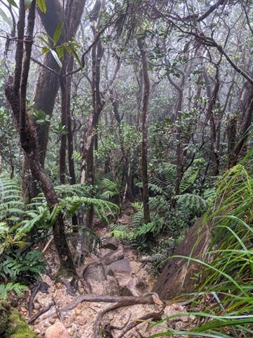
Part of the lower trail through rainforest.
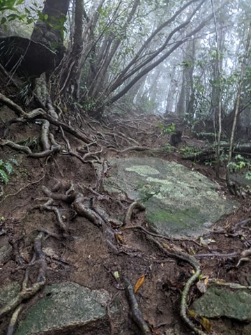
Steep ascending up eroded rainforest
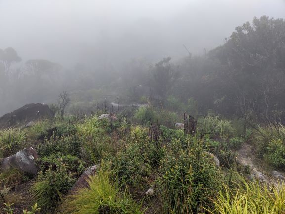
I found the tropical alpine tundra fascinating as it is very different to what we have around Kosciusko National Park and Namadgi National Park where I usually live in Canberra. Where the tundra starts is also where there is a metal hut, some elevated wooden sites for camping and a very small circular clearing I assume is where helicopters can land in good weather. Many people have died and been seriously injured on Mt Bartle Frere which is why they have built this shelter and helicopter clearing. After the tundra the boulder field begins. In dry conditions this would be fun, but in wet conditions, it is treacherously slippery, with the consequence of a slip being a fair drop off in parts. It is not surprising that there have been injuries and deaths here. The bouldering reminded me a bit of the boulders around Cradle Mountain summit in Tasmania, but larger and requiring much more reach to get around. Visibility was very poor at this point because of the cloud whipping around. Although well sign posted with orange reflectors, I often could not see more than one metre in front, so had to guess what direction to go in.
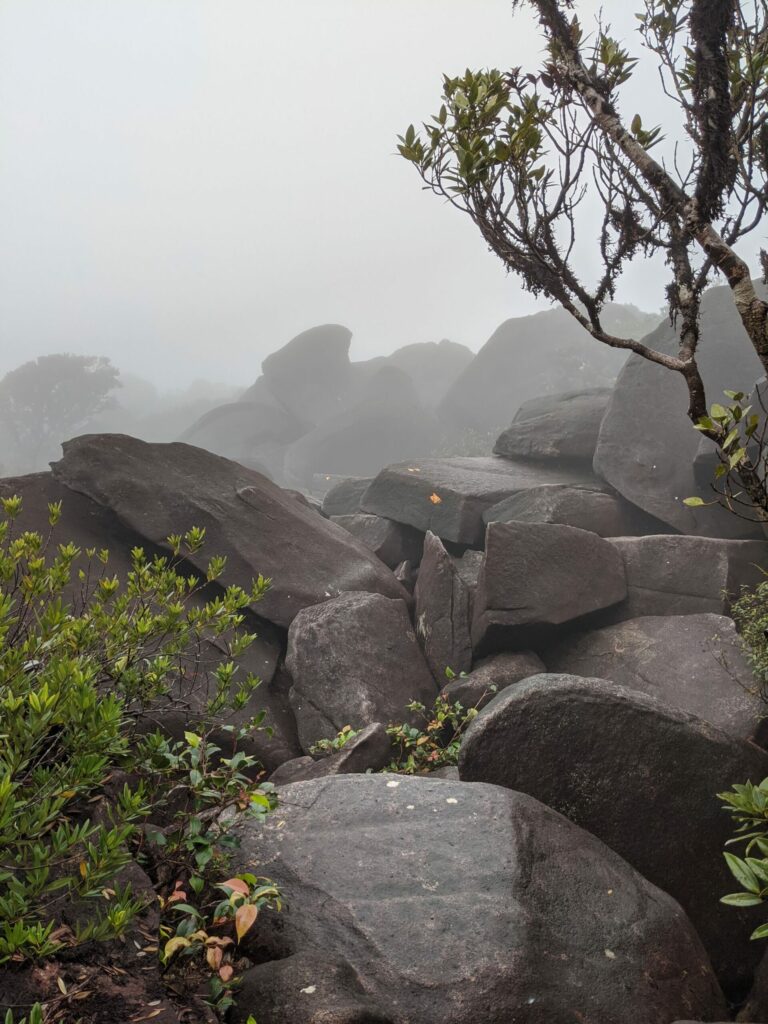
Boulder field
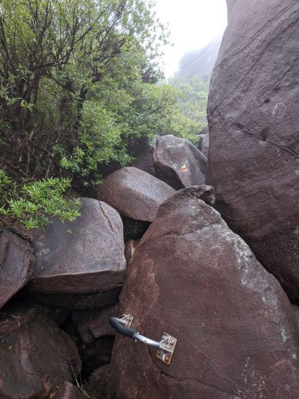
One of the hand holds on the boulder field. You can see the small orange reflectors to follow through the field.
Finally the boulder fields makes way to the last half kilometre which is again in rainforest (though slightly stunted due to the elevation), up a very eroded almost vertical creek bed. At the top there is a sign where the western ascent and eastern ascent meet. At the top I took off all my clothes to remove leeches. This is not my first time in north queensland, so I easily found the leeches in my bra and behind one ear and then put everything back on for the descent including my rain jacket.
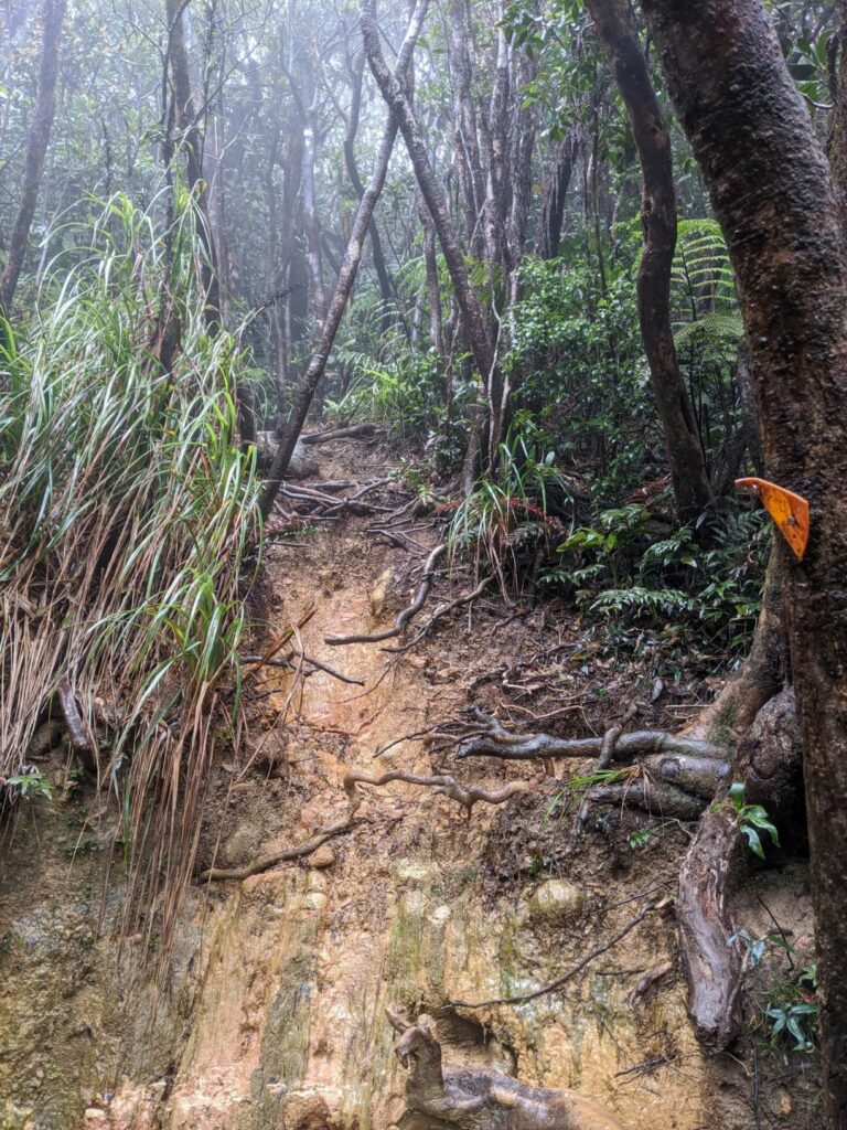
The last part of the trail to the summit.
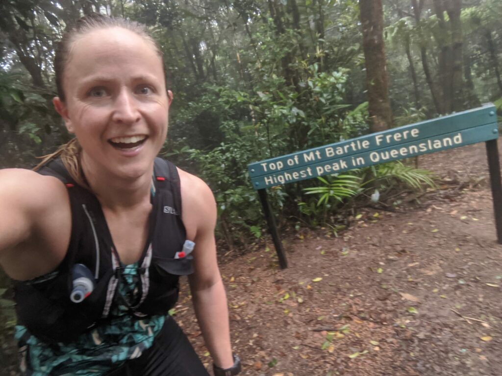
No views at the summit. Just a small clearing to assist with removing leeches while not getting an equal number of new leeches.
Descending was more treacherous than the ascent, but that is often the case and I was careful particularly on the boulder field. I passed a few people on the descent and it was nice to see some human life. After the boulder field I relaxed a little, slipping occasionally on rainforest roots but not worrying too much until about half way down when I did not see a rock and smashed my left patella straight into it. I had searing pain and blood immediately streamed down my leg but I knew I had to keep moving or it would completely stiffen up if I slowed to a hike. So I kept hobbling down the mountain, continuing to slip here and there and probably scaring a few hikers I passed with the blood. It was such a relief to be spat out of the rainforest into Josephine Falls carpark. I stopped to inspect what I had thought was a wound forming on me knee but on closer inspection it was two massive leeches feasting on my knee wound. It was such bliss sitting in the creek looking at Josephine Falls afterwards.
It took me 2hr 20min to get to the summit and 1hr 45min to get back down. These times show just how technical and steep the climbing is. If you are lucky enough to get a dry day it would be safer to go at a faster speed, particularly on the descent. There is no water after 3km on the trail so bringing enough is very important. I drank 1L on the way up and 500mL on the descent but could have used more. I ate one packet of skratch lab chews but again should have brought more fuel with me.
Tropical sub alpine tundra about 1,400m above sea level.
Trail just after the hut.
Mt Halifax
Mt Halifax is only 1,000m high, but on hearing it is one of the most technical mountain trails in Queensland I had to have a go. The climb to the top is 6km, 1000m of vertical gain. On inspecting the topographic map the first 2-3km appeared runnable before the track veers to a very steep scramble. I was very wrong about the first couple of kilometres.
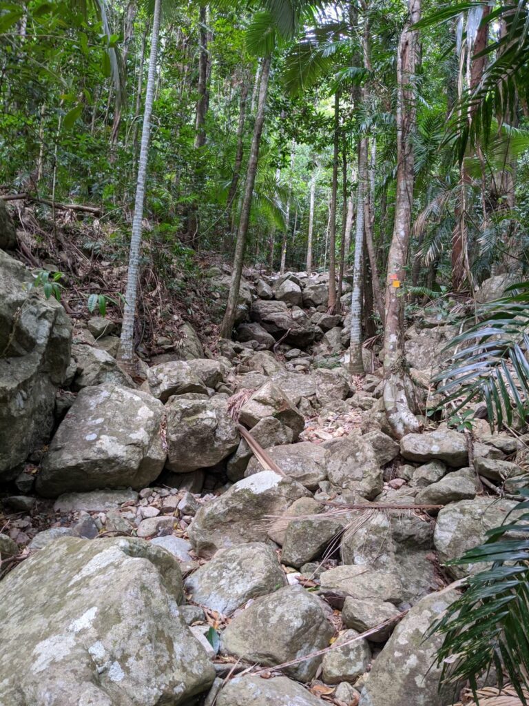
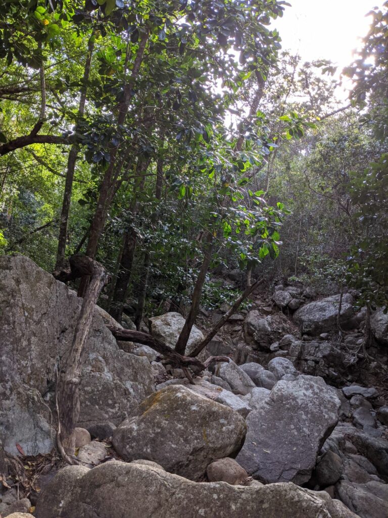
The trail begins at the Pace Farm gate at the end of Pace Rd off the Bruce Highway, near Rollingstone, north of Townsville. After driving down Pace Rd through Cane Fields, you park outside a very unassuming gate. Mr Pace himself was driving by as I was parking and explained that I needed to park much further from the gate to allow room for farm machinery. This hike initially goes along the Pace Farm property before going into national park, so if you do this hike respect the parking signs and the farm as you park and start the hike. There is no fancy signage, but it is clear that the track starts down a firetrail to the right immediately after walking through the gate. I started jogging and within 100m a green tree snake ran across in front of me. The firetrail continued and within 800m I had seen another two snakes, this time small brown snakes. I usually have a ‘three snakes in the first km and turn back’ rule. However I had come so far off the beaten track to get to this trail I decided to keep going at a slower pace. I had seen the snakes with plenty of time and being already 27 degrees they were warm enough to get away from me quickly. Soon the trail turned to single trail and then joined a creek. The next 2.5 kilometres were straight up a creek bed bouldering over large rocks, with a few excursions off to the side to run through fairly rocky, technical rainforest. The creek bed had water in parts but was mainly dry due to it being the end of dry season. I saw six more snakes in this section, mainly red belly black snakes, but also one enormous diamond python. The snake highlight was probably when a red belly escaped from me by going in the water and under a rock (did you know these snakes not only swim but can submerge themselves in water for long periods of time???). Turned out I had to step on this rock to cross to the other side of the creek. I definitely was not wading through that water at ankle biting height. After waiting for a couple of minutes and the snake not moving I decided to jump on the rock across the river regardless. I have never sprinted so fast after a rock jump. I did not get bitten and I hope I did not squash the snake. Anyway, you get the idea of how slow I was going for snake safety. It was bit like jump onto a rock, stamp feet, let the snakes move off surrounding rocks, when the slithering noises stop jump onto the next boulder, and repeat.
The trail goes straight up the creek bed. You can see the purple rope in the bottom right for getting up through this section.
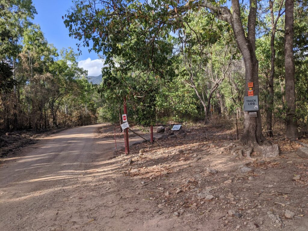
Trail registration box at the Pace Rd gate. Trail starts immediately to the right after the gate.
Trail goes straight up this rock slide.
Some more rocky trail. You can see how dry it is at the end of dry season. I imagine in wet season it would be very slippery.
After 3km the path mercifully left the creek bed and veered steeper into the rainforest. Soon I reached what is called the ‘rock slide’, which can be described as a scree slope, but is so eroded where you go up it is more near vertical slick soil. There are ropes at this point and it would likely be impossible to get up without them. After the main rockslide there are sections of rooty rainforest interspersed with more rock bouldering and rope assisted climbing. Eventually I made it to the ridge line which was surprisingly covered by casuarina forest. There were fantastic views at Echo Point and then some more climbing. After a couple of false summits, the vegetation changed to rainforest and the last part to the summit was nice and shady rainforest with a ferny gully preceding the last climbing. The views at the top across the ocean were spectacular. My phone had gone flat by this point though so unfortunately I do not have any photos. The ascent took about 1hr 50min at a careful ‘run’/power hike.
Initially I had fun on the descent. I love the thrill of tricky descending in isolated places. On the rope sections I found it was quicker to face away from the mountain (descending forwards as you would a normal hill). I slipped a few times and on the final time cracked the back of my head on a rock. After that I changed to normal abseiling technique (facing mountain, descending backwards) as I was feeling a bit dizzy. I was dreading returning to the creekbed, but apart from seeing the mega diamond python from a distance, there were no snakes on the way back, probably because it was too hot for them to be in the direct sunlight on the rocks by this point. Mt Halifax is a nice technical trail with a lot of rope work best done with others for safety. At the same time it was a good solo challenge and if you are similarly experienced and prepared you could also attempt it solo. Being on the southern edge of the wet tropics it can be done as a daytrip from Townsville or on the way to Paluma village.