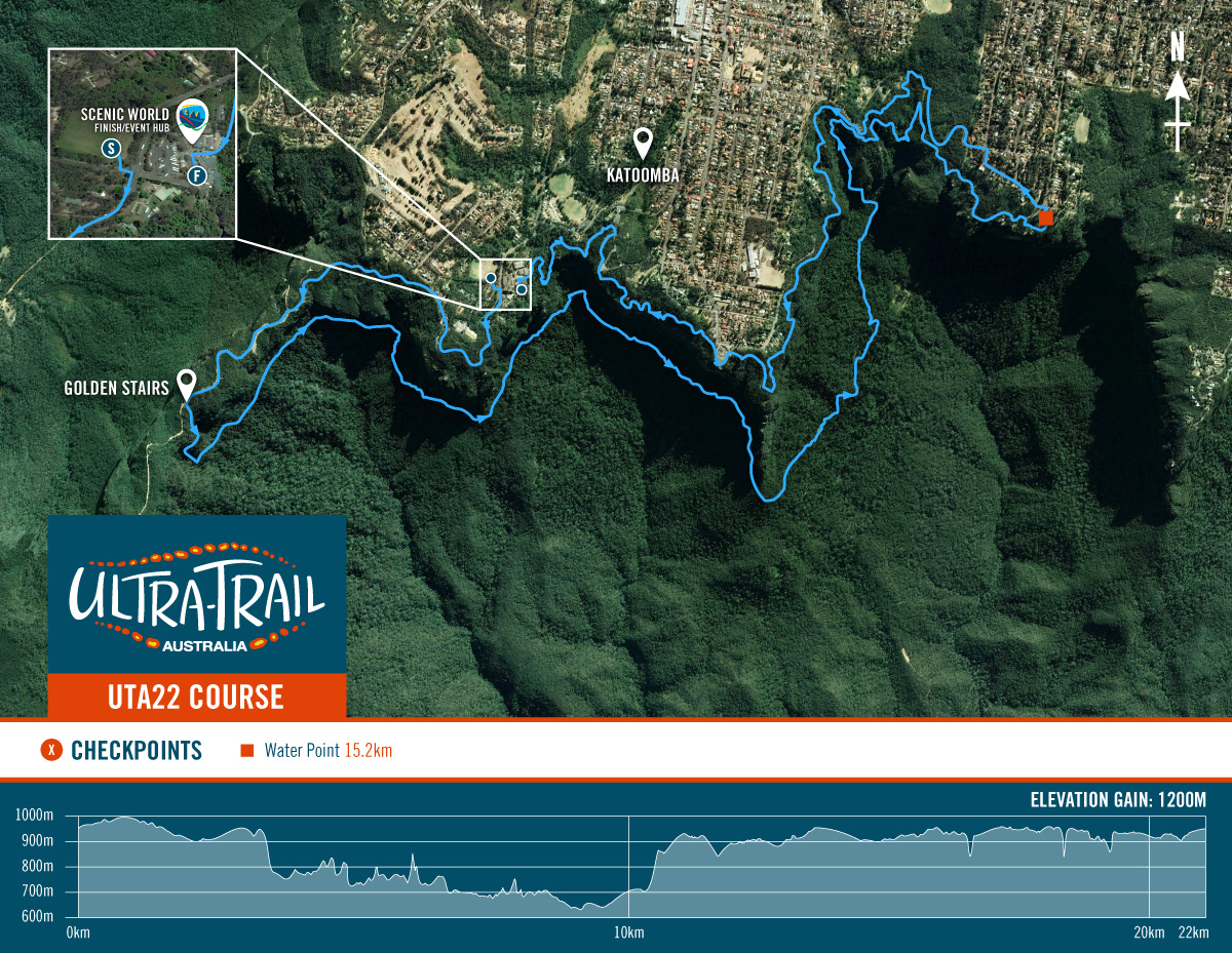
Course notes – UTA22
Introduction
The UTA22 course is a completely different and fresh course in 2021. Heavy on the single trail and technical running it will favour pure trail runners. The old course was a point to point predominantly on firetrail except the single trail on Federal Pass and the Furber stairs at the end. The new course has a lot more rocks, roots and steps and is also a lot more fun. Before reading on, just a reminder that parts of the course including the Golden Stairs are currently closed. If you go and train on course please respect these closures. If you don’t, you will be fined, UTA organisers can take away your entry, and you are jeopardising the future ability of race directors to get permission to run events in these wild places. It is such a privilege to be able to race through the Blue Mountains National Park. Let’s not lose this through blatant disrespect. OK course notes – let’s go.
Start
The start line is on the grassy oval on the corner of Violet St and Cliff Drive (I believe it is called KCC Oval). After leaving the oval it is onto the bitumen on Cliff Drive into an immediate uphill. The bitumen continues around Cliff Drive and onto Glenraphael Drive. The race then heads onto the narrow neck plateau trail, a wide and well graded firetrail similar to what you get in the old course descending into the valley. I believe this is the only firetrail on the course so enjoy the smooth speed and leg turnover. There is a gentle descent followed by a gentle climb and then boom – you are at the Golden Stairs and the trail running starts.
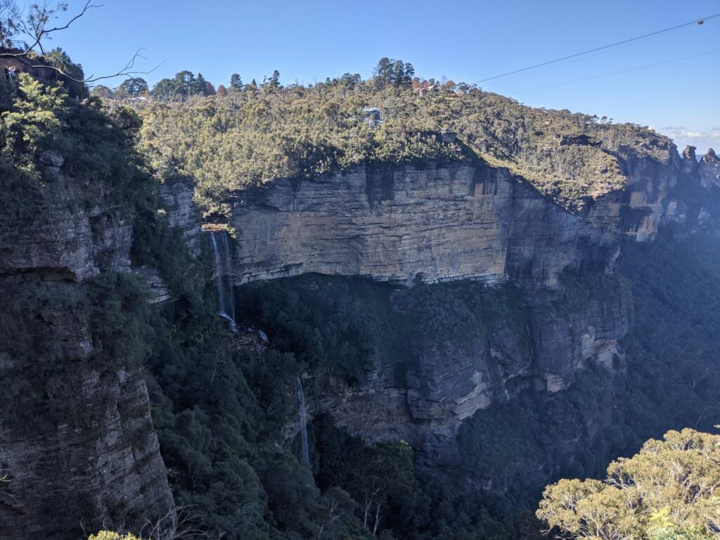
Golden Stairs
The Golden Stairs is a steep and exhilarating descent over about 800m with an average gradient of 26%. If you have small feet you might have fun as you can fit a whole foot on each bush step. If you have large feet you might need to use some kind of tip toe or side foot technique. Either way I hope you have been training your quads for the eccentric load. At the bottom of the stairs turn left to the landslide. Although turning right leads to the glorious Ruined Castle and also the ominous Mt Solitary, these landmarks are not part of the UTA. So turn left.
I didn’t go on the Golden Stairs to recce them as they are closed, so my recollection is from a few years ago. Either way it will be a steep descent on bush stairs
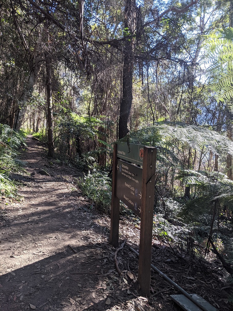
Smooth single trail at the base of Golden Stairs
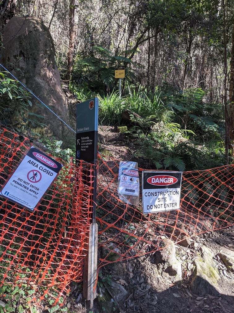
Golden Stairs currently closed.
Golden Stairs to Furber Stairs
The first part of the Federal Pass is a flatter and less technical single trail so go hard here. It is also quite shady so if it’s a hot day (unlikely in May) it is a good section to run hard. After about 1.6km you will come to the landslide section, which is technical, rocky and exposed and may require some scrambling. The track traverses an old landslide that occurred in 1931 when the area was mined for coal. I found this technical section fun, but if you don’t do much technical running I’d be careful here because it’s the number one place in the course to have a pretty bad stack. The rocks are all pointy and unforgiving so even a minor stumble could leave you fairly cut up. After the landslide the single track continues, less technical than before but not as smooth as the section before the landslide. Watch for roots and small rocks and several small log jumps. You will pass the base of the Furber Stairs check point. Continue straight along the Federal Pass.
Furber Stairs to Fern Bower climb
You get to run along the whole of the Federal Pass. This next section is gorgeous, nestled in shady and temperate rainforest. From Furber Stairs the next 1.7km of the Federal Pass is a single trail but with quite a few bush stairs thrown in. This is a nice warm up for the stairs to come. Passing underneath the Three Sisters you will then arrive at the intersection with Dardenelles Pass/Giant Stairway. Continue straight along the Federal Pass. From here there is a noticeable descent and the single trail is wet, muddy and more technical in places with some more log jumps. There is a gentle rise in the single trail after Banksia Streamlet, and once your watch clicks over 10km the game is on because you are about to climb super steeply out of the valley.
Fern Bower climb to Leuralla Amphitheatre
The climb out of the valley is via the Fern Bower stairs which is a 27% average gradient over 800m that follows Linda Creek and its numerous falls and cascades. The number of stairs is approximately 997. I don’t recommend counting the stairs. Instead try and lose yourself in the scenery and rhythm of climbing. In my opinion this is a harder climb than the Furber Stairs. It is steeper and while Furber has a variety of different stair types at different heights and intervals, the stairs on Fern Bower are exactly the same size and height all the way up. The width of the stairs is also quite narrow so large footed people may not always fit a whole foot on. It is fairly unrelenting with a few short flat platforms thrown in near waterfalls. So there is no hiding or changing rhythm. I’d also like to point out that because this is near cliffs, the segment likely won’t register correctly. So if you have a target time, time yourself, don’t rely on the strava segment (this is the same for most of the stair climbs in the area). My segment time was 2mins off my actual time.
While climbing take in the cool ambience and waterfall spray. You will pass by Marguerite Cascades, Linda Falls, and Lila Falls before reaching the merciful top. The single trail then continues with a smaller descent to Leura Cascades and back up and along past Olympian Rock and Elysian Rock. I didn’t get to practice this part of the course because of trails closures but I believe it is a mix of stairs and single trail. On reaching Leuralla Amphitheatre check point you have finished the most technical running on the course.
Leuralla Amphitheatre to Echo Point
So starts the road section of the course. 12% of the course is road and most of it is in this section. So make sure your trail shoes are ok on the road but if in doubt choose a shoe that is going to be good on technical single trail because that makes up 80% of the course. After Olympian Parade the course turns left onto Cliff Drive, cutting through Leura Cascades Picnic Area before rejoining Cliff Drive again. The roads undulate and are not flat but after all the technical running, this section feels fast. If you have legs left at this point, this will be a good section to go fast and get some leg turnover happening. Eventually the course rejoins Prince Henry Cliff walk and the road section is over. The single trail in this section is dry and rocky, predominantly dry eucalypt and banksia, and passes several lookouts. When you reach the sealed path leading to Echo Point this is when to turn on the gas (and start weaving through the tourists).
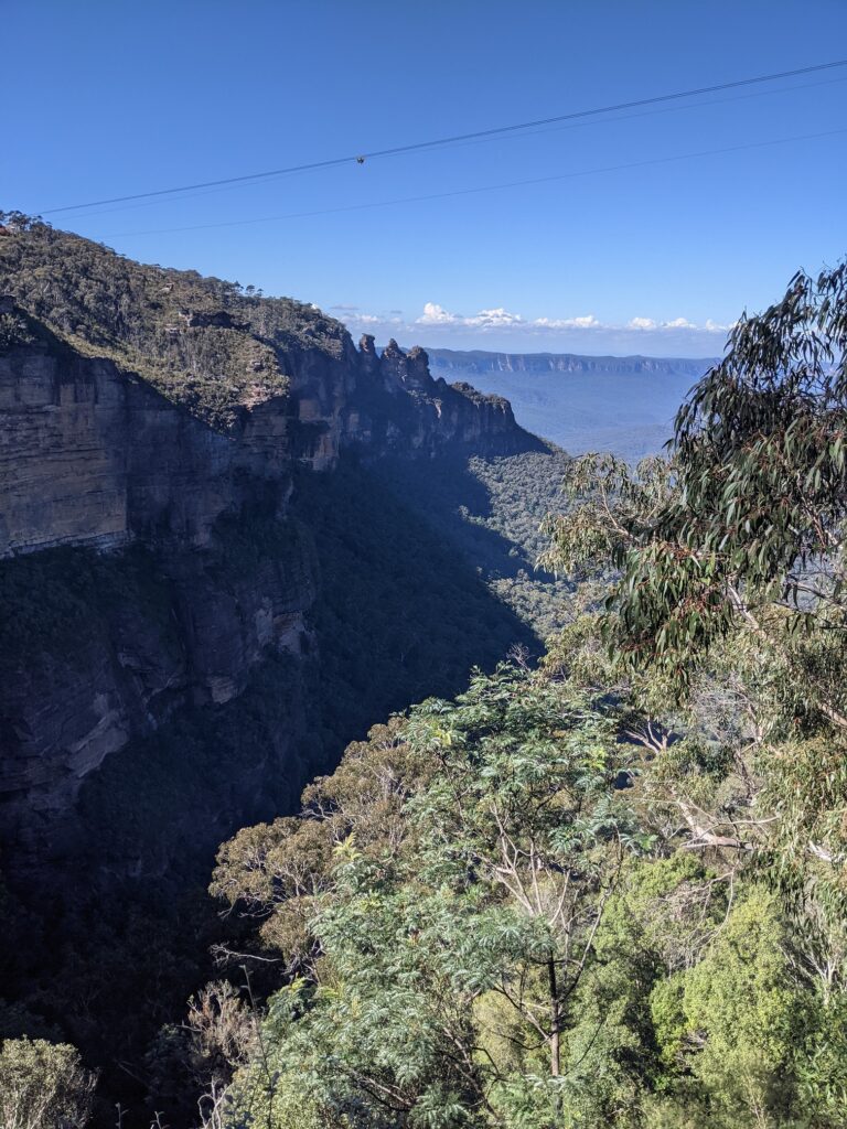
View from near the top of Furber Stairs. Three Sisters in the distance.
View of Katoomba Falls.
Echo point to Finish at Scenic World
Rejoining the Prince Henry Cliff Walk from the other side of Echo Point, the single trail continues. This section is relatively flat and fast before taking a steep left and descending some steep stairs to cross the Katoomaba Cascades and then some stairs to climb out. From here the finish line seems close but it is all technical running. The course descends Witches Leap rainforest area, which involves numerous bush stairs which can be slippery. After passing the rainforest lookout you meet your old friend the Furber Stairs. Fortunately you are only going up the last third of the stair case, but you have already been up over 1,100 stairs during the race, so even one third of the Furber Stairs is a mammoth effort. The finish line lies tantalisingly at the top. After the final slog, run along the board walk and cross the finish line to claim your bling and glory.
Disclaimer: with all the trail closures from the recent flooding the course is always subject to change. I may have run the course incorrectly. UTA can change the course at any time. Always follow the course markings. Do not rely on my course notes for any kind of navigating or directions.